Stonehaugh Campsite
Detta ställe tar för tillfället inte emot bokningar här på Pitchup.com.
Om du är det här ställets ägare kan du börja ta emot bokningar via Pitchup.com.
Det är gratis, snabbt och enkelt!
Typ av ställe
Turistnämndsbetyg
Talade språk
![]() Engelska
Engelska
Närmast liggande ställen

Det finns tyvärr inga bokningsbara ställen i närheten.
Vill du veta mer om camping i Northumberland?
Egenskaper
![]() Hundar tillåtna
Hundar tillåtna
Aktiviteter på platsen
Bar eller klubbhus
Barnklubb
Cykeluthyrning
Fiske
Fitnesscenter
Inomhusbad
Kvällsunderhållning
Lekplats
Restaurang/cafe på stället
Spelrum
Takeaway
Tennis
Tv-rum
Utomhuspool
Vattensport
Bekvämligheter på platsen
Badkar tillgängligt
Bilparkering vid boendet/enheten
Bärbar toalett
Diskutrymme
Dusch tillgänglig
Familjetoaletter
Gratis WiFi
Handikappanpassade anläggningar
Hundrastgård
Hämtning från kollektivtrafik
Internetanslutning
Komposttoalett
Kylning av kylklampar
Matbutik
Offentlig telefon
Toalettblock
Toaletter på puben
Torkrum
Tvättomat
WiFi
Grupper är välkomna
Familjevänligt
Grupper av samma kön är välkomna
Lämpligt för motorcyklar
Skolklasser är välkomna
Studentgrupper är välkomna
Välkomstevent
Regler
Grillning tillåts
Hundar tillåtna
Kommersiella fordon tillåts
Lägereldar tillåtna
Tillgång till grill
Teman
Avlägsen plats
Lugn
Naturparadis
Paradis för vandrare
Tjänster
Förnybar energi
Gasflaskor tillgängliga
Laddningsmöjligheter
Laddstationer för elbilar
Tömning av kemiskt avfall
Återvinning tillgänglig
Bekvämligheter i närheten
Bar i närheten
Hundvänligt område i närheten
Typ
Mellanstor (26–50 platser)
Aktiviteter i närheten
Bergscykling i närheten
Cykling i närheten
Golf i närheten
Läge
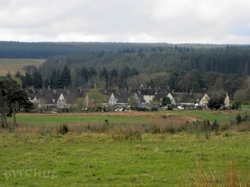
Stonehaugh Campsite
Stonehaugh Campsite
Stonehaugh Shields
Hexham
Northumberland
England
NE48 3BU
Tidszon
Europe/London +0100 (GMT+01:00)
GPS
55,08065° N
−2,32281° W
Vägbeskrivning
Närmaste transport
Observera: Alla avstånd på den här sidan mäts fågelvägen – kontrollera det egentliga avståndet beroende på hur du reser genom att använda knappen 'Få vägbeskrivning' ovan.
Lokala sevärdheter
Måste ses
Housesteads Roman Fort 7,5 km
Vindolanda (Chesterholm) Hadrian's Wall 10,2 km
Chesters Roman Fort 13 km
Hadrian's Wall Path National Trail 19,1 km
Birdoswald Roman Fort 20,5 km
National Trust
Hadrian's Wall and Housesteads Fort 7,7 km
Allen Banks and Staward Gorge 12,7 km
Wallington 24,6 km
Cherryburn 31,1 km
Cragside 38,1 km
Cykelleder
Hitta lokala leder på National Cycle Network – över 19 000 km cykelleder.
Annat
Stonehaugh - Linacres - Roses Bower 0,6 km
Stonehaugh Circular (including Pennine Way) 0,6 km
Hadrian's Wall Part 5 - Housesteads to Port Gate 7,5 km
HESLEYSIDE 7,8 km
Housesteads - Once Brewed - Vindolanda - Housesteads 7,9 km
Observera: Alla avstånd på den här sidan mäts fågelvägen – kontrollera det egentliga avståndet beroende på hur du reser genom att använda knappen 'Få vägbeskrivning' ovan.
Recensioner
Inga recensioner ännu.
- Finns det pool på Stonehaugh Campsite? Nej Visa alla egenskaper
- Är Stonehaugh Campsite hundvänligt? Ja Visa alla egenskaper
- Vad finns det för sevärdheter i närheten av Stonehaugh Campsite? THE AREA Kielder water and Forest Park: Kielder Water is the biggest man-made lake in northern Europe and the Forest is biggest working forest in England. There are three visitor Centres around … Läs mera