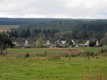
Stonehaugh Campsite

Site close to picturesque village of Stonehaugh. (added by manager 14 Jan 2013)

Ten obiekt nie przyjmuje obecnie rezerwacji na Pitchup.com.

Jeśli jesteś właścicielem tego obiektu, zacznij przyjmować rezerwacje za pośrednictwem Pitchup.com.
Bezpłatnie, szybko i łatwo!

Dodaj dane swojej firmy

THE CAMPSITE: A rural site in Northumberland National Park, mid way between Hexham and Kielder Water. Only an hour’s drive from the centre of Newcastle the site is set amongst attractive moor land and forest scenery on the edge or Wark Forest. We aim to provide a quiet and relaxed Campsite where you can enjoy the natural countryside of Northumberland. The quiet village of Stonehaugh (pronounced Stone-hoff) was designed in 1951 as a village for Forestry Commission workers at the time that Wark Forest was being planted. While around 250 houses were originally planned only 34 were ever built! The Campsite opens on 1 April (or Easter if this is earlier) and closes on 30 September. There is easy access to walking with footpaths (including the Pennine Way) close by. Cyclists will find numerous forest tracks and the North Pennine Cycle Route (NCN 68) passes close to the village. The site is comparatively flat and is suitable for tents, touring caravans and motor homes. For those looking for a base to tour Northumbria by car the site is central to: • Hexham - about 17 miles • Bellingham - about 10 miles • Kielder Water – about 25 miles • Hadrian’s Wall – about 12 miles • Newcastle – about 35 miles The site is designed to minimise its affect on the environment with the shower block powered by a wind turbine and hot water provided by solar panels. In 2012 the site was rated as 2 stars by Visit England. You can view their independent report here. (Attach report) CAMPSITE FACILITIES Main Shower Block: There is a shower block on the site that provides: • 3 Men’s Showers • 3 Ladies Showers • 7 toilets in total • Shaver sockets • Sink for washing up pots and pans • A family bathroom with a wash hand basin and toilet Drinking water: In addition to the shower block there are three taps located around the site. Waste Disposal: There is a facility for the disposal of Chemical Closet waste. Refuse bins are located around the site. A glass recycling facility is available in the Village (250 metres). Picnic Tables: There are several picnic tables around the site Electrical Hook-ups: There are a limited number of low power (6amp), electrical hook-ups. These need to be booked in advance. THE VILLAGE Children’s Adventure Play Area: There is a play area in the Village (5mins walk from the campsite) that is suitable for Children up to 10yrs of age. It includes swings, slide and an aerial runway. Stonehaugh Community Village Hall The Village has developed a Scandinavian style Village Hall which incorporates Stonehaugh Social Club. The Club is open Thursday to Sunday evenings inclusive. A cooked breakfast is available in the Hall on Saturday and Sunday Mornings 8.30am to 10.00am (This needs to be ordered at the Club the night before) Warksburn Picnic area: Warksburn Picnic Area is a ten minute stroll from the Campsite. Set under the three famous Totem Poles it’s a perfect place for a picnic and a paddle in the burn. Two way-marked forest walks start and finish at the picnic area. SHOPS There are no shops in the village so make sure you bring supplies! There is a small shop/newsagent in Wark (6 Miles). The nearest supermarkets are in Bellingham (10 miles) and Hexham (17 miles).

Rodzaj obiektu

Parcele dla namiotów 30
Parcele dla przyczep kempingowych 30

Ocena organizacji turystycznych

Używane języki

Angielski

Najbliższe obiekty

Niestety nie mamy żadnych obiektów w pobliżu z możliwością rezerwacji.

Chcesz dowiedzieć się więcej o biwakowaniu w: Northumberland?

Funkcje

Zajęcia wypoczynkowe na kempingu

Bar lub klub

Centrum fitness

Klub dla dzieci

Kryty basen

Na wynos

Odkryty basen

Plac zabaw

Pokój z telewizją

Restauracja/kawiarnia na miejscu

Sala gier

Sporty wodne

Tenis

Wieczorna rozrywka

Wypożyczalnia rowerów

Wędkarstwo

Udogodnienia

Automat telefoniczny

Bezpłatne Wi-Fi

Internet

Odbiór ze stacji/lotniska

Park dla psów

Parking obok obiektu/jednostki

Pralnia

Prysznic dostępny

Sklep spożywczy

Suszalnia

Toaleta kompostująca

Toaleta przenośna

Toalety

Toalety w pubie

Udogodnienia dla niepełnosprawnych

Wanna dostępna

Wi-Fi

Wkłady lodowe, mrożące

Zlew

Łazienka dla rodzin z dziećmi

Mile widziane grupy

Dla rodzin

Mile widziane grupy studenckie

Mile widziane grupy tej samej płci

Odpowiednie dla motocykli

Odpowiednie dla zgromadzeń

Wycieczki szkolne

Zasady

Dozwolone grillowanie

Dozwolone pojazdy użytkowe

Ogniska dozwolone

Psy akceptowane

Sprzęt do grillowania na wyposażeniu

Motywy

Naturalny raj

Odległa lokalizacja

Raj dla miłośników spacerów

Spokojna okolica

Usługi komunalne

Dostępne butle gazowe

Energia odnawialna

Recykling dostępny

Sprzęt do ładowania

Stacje ładowania samochodów elektrycznych

Usuwanie chemicznych odpadów

Pobliskie udogodnienia

Bar w okolicy

Wybieg dla psów w pobliżu

Rodzaj

Średnie (parcele 26-50)

Zajęcia wypoczynkowe w okolicy

Górskie trasy rowerowe w okolicy

Pole golfowe w okolicy

Trasy rowerowe w pobliżu

Miejsce

Stonehaugh Campsite

Stonehaugh Campsite

Stonehaugh Shields

Hexham

Northumberland

Anglia

NE48 3BU

Trasa dojazdu

Strefa czasowa

Europe/London +0100 (GMT+01:00)

GPS

55,08065°N
-2,32281°W

Wskazówki dojazdu

Follow directions to Stonehaugh Village. We are situated between Bellingham (10 miles) to the north and Hexham (17 miles) to the South. We are mid way between Carlisle and Newcastle - both around 40 miles. Wark village is 6 miles away. Step by step directions to the site can be found on our website at stonehaughcampsite.com From the A1/ Newcastle • From the A1 (North or south) take the A69 towards Hexham. • As you approach Hexham there is a Major Roundabout - go straight over and stay on the A69 • After the roundabout get into the right hand lane as soon as you can. • After about half a mile take a right turn signposted to Acomb & Bellingham • Stay on this road through Acomb and then through Wall. • Shortly after Wall you will come to a Junction/Crossroads • At this junction turn left down the bank towards Chollerford. • Go over the bridge • Immediately after the bridge, by 'The George' hotel there is a roundabout - Go straight over • Stay on this road for about 6 miles • After about six miles take turn off to the left for Stonehaugh. Watch out for this turn! • You now go onto a single track road with passing places. • After about 5 miles there is a right turn signposted to Stonehaugh (and the campsite) • When you get to Stonehaugh turn right and go down the centre of the village • When you get to the telephone box continue straight down the stone track. • Campsite reception is 200yds down the track. From Carlisle/ the West • Take the A69 towards Hexham • Drive past the turn off on the right for Hexham • Take the next turn off on the left signposted to Acomb & Bellingham • Stay on this road through Acomb and then through Wall. • Shortly after Wall you will come to a Junction/Crossroads • At this junction turn left down the bank towards Chollerford. • Go over the bridge • Immediately after the bridge, by 'The George' hotel there is a roundabout - Go straight over. • Stay on this road for about 6 miles • After about six miles take turn off to the left to Stonehaugh. Watch out for this turnoff! • You now go onto a single track road with passing places. • After about 5 miles there is a right turn signposted to Stonehaugh (and the campsite) • When you get to Stonehaugh turn right and go down the centre of the village • When you get to the telephone box continue straight down the stone track. • Campsite reception is 200yds down the track.

Najbliższy transport

Autokar
19,1 km Percy Arms
19,1 km Percy Arms
21,5 km Hotel
Linia kolejowa
11,9 km Bardon Mill Rail Station
12,7 km Haydon Bridge Rail Station
15,4 km Haltwhistle Rail Station
Prom
14,4 km Tower Knowe Ferry Landing
16,4 km Belvedere Ferry Landing
17,8 km Leaplish Ferry Landing
Lotnisko
39,5 km Newcastle International Airport

Uwaga: Wszystkie odległości na tej stronie są obliczane w linii prostej – sprawdź rzeczywistą odległość, biorąc pod uwagę swój sposób podróżowania i naciskając powyższy przycisk „Wyznacz trasę dojazdu”.

Lokalne atrakcje

THE AREA Kielder water and Forest Park: Kielder Water is the biggest man-made lake in northern Europe and the Forest is biggest working forest in England. There are three visitor Centres around the reservoir and many activities including: • Fishing • Water sports • Ferry ride • Walking • Cycling • Kielder Observatory • Etc. Hadrian’s Wall: Hadrian's Wall is a World Heritage Site. Constructed in AD 122 on the order of Emperor Hadrian it is 73 miles long and represents the most northern part of the Roman Empire. Large sections of the wall still remain and there are many walks around the wall with visitor centres to see the remains of excavated forts and temples. Cycling: There are numerous trails in the forest around the Campsite. For the more serious cyclist the North Pennine Cycleway (Route 68) runs close to the site. The ‘Hadrian’s Cycleway’ (Route72) and ‘Border Reiver’s’ (Regional Route 10) are within a few miles. Walking: There are several footpaths some of which can be accessed directly from the Campsite. There are popular walks to Roses Bower & the Long Drop and to the Middleburn waterfall. Two way marked forest walks start and finish at the Walkburn picnic area Hadrian’s Wall is approximately eight miles on foot. The long distance ‘Pennine Way’ runs approximately one mile from the site. Hexham: Hexham (17 miles by car) is a historic market town in the heart of the Tyne Valley. In addition to Shops, Cafes, the Leisure Centre, Arts Centre and Racecourse you could visit: • Hexham Abbey built around 675AD • The Old Gaol – the oldest purpose built gaol in England Bellingham: Bellingham (10 miles by car but shorter on foot) is on the banks of the North Tyne. There are shops, a cafe, three pubs and the Bellingham Heritage centre.

To trzeba zobaczyć

Housesteads Roman Fort 7,5 km

Vindolanda (Chesterholm) Hadrian's Wall 10,2 km

Chesters Roman Fort 13 km

Hadrian's Wall Path National Trail 19,1 km

Birdoswald Roman Fort 20,5 km

National Trust

Hadrian's Wall and Housesteads Fort 7,7 km

Allen Banks and Staward Gorge 12,7 km

Wallington 24,6 km

Cherryburn 31,1 km

Cragside 38,1 km

Trasy rowerowe

Znajdź lokalne trasy będące częścią krajowej sieci tras rowerowych – ponad 20 tysięcy kilometrów tras rowerowych.

Inne

Stonehaugh - Linacres - Roses Bower 0,6 km

Stonehaugh Circular (including Pennine Way) 0,6 km

Hadrian's Wall Part 5 - Housesteads to Port Gate 7,5 km

HESLEYSIDE 7,8 km

Housesteads - Once Brewed - Vindolanda - Housesteads 7,9 km

Uwaga: Wszystkie odległości na tej stronie są obliczane w linii prostej – sprawdź rzeczywistą odległość, biorąc pod uwagę swój sposób podróżowania i naciskając powyższy przycisk „Wyznacz trasę dojazdu”.

Recenzje

Brak recenzji.

  • Czy w Stonehaugh Campsite znajduje się basen? Nie Zobacz wszystkie opcje
  • Czy w Stonehaugh Campsite akceptowane są zwierzęta? Tak Zobacz wszystkie opcje
  • Jakie są atrakcje w pobliżu Stonehaugh Campsite? THE AREA Kielder water and Forest Park: Kielder Water is the biggest man-made lake in northern Europe and the Forest is biggest working forest in England. There are three visitor Centres around … Czytaj więcej