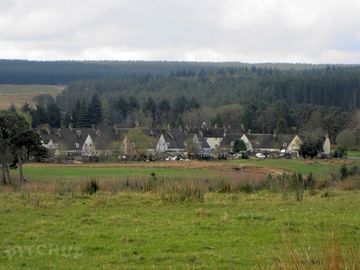
Stonehaugh Campsite

Site close to picturesque village of Stonehaugh. (added by manager 14 Jan 2013)

Denne enhed modtager i øjeblikket ikke reservationer her på Pitchup.com.

Hvis du er ejer af dette sted, kan du begynde at modtage reservationer gennem Pitchup.com.
Det er gratis, hurtig og nemt!

Tilføj oplysninger om din virksomhed

THE CAMPSITE: A rural site in Northumberland National Park, mid way between Hexham and Kielder Water. Only an hour’s drive from the centre of Newcastle the site is set amongst attractive moor land and forest scenery on the edge or Wark Forest. We aim to provide a quiet and relaxed Campsite where you can enjoy the natural countryside of Northumberland. The quiet village of Stonehaugh (pronounced Stone-hoff) was designed in 1951 as a village for Forestry Commission workers at the time that Wark Forest was being planted. While around 250 houses were originally planned only 34 were ever built! The Campsite opens on 1 April (or Easter if this is earlier) and closes on 30 September. There is easy access to walking with footpaths (including the Pennine Way) close by. Cyclists will find numerous forest tracks and the North Pennine Cycle Route (NCN 68) passes close to the village. The site is comparatively flat and is suitable for tents, touring caravans and motor homes. For those looking for a base to tour Northumbria by car the site is central to: • Hexham - about 17 miles • Bellingham - about 10 miles • Kielder Water – about 25 miles • Hadrian’s Wall – about 12 miles • Newcastle – about 35 miles The site is designed to minimise its affect on the environment with the shower block powered by a wind turbine and hot water provided by solar panels. In 2012 the site was rated as 2 stars by Visit England. You can view their independent report here. (Attach report) CAMPSITE FACILITIES Main Shower Block: There is a shower block on the site that provides: • 3 Men’s Showers • 3 Ladies Showers • 7 toilets in total • Shaver sockets • Sink for washing up pots and pans • A family bathroom with a wash hand basin and toilet Drinking water: In addition to the shower block there are three taps located around the site. Waste Disposal: There is a facility for the disposal of Chemical Closet waste. Refuse bins are located around the site. A glass recycling facility is available in the Village (250 metres). Picnic Tables: There are several picnic tables around the site Electrical Hook-ups: There are a limited number of low power (6amp), electrical hook-ups. These need to be booked in advance. THE VILLAGE Children’s Adventure Play Area: There is a play area in the Village (5mins walk from the campsite) that is suitable for Children up to 10yrs of age. It includes swings, slide and an aerial runway. Stonehaugh Community Village Hall The Village has developed a Scandinavian style Village Hall which incorporates Stonehaugh Social Club. The Club is open Thursday to Sunday evenings inclusive. A cooked breakfast is available in the Hall on Saturday and Sunday Mornings 8.30am to 10.00am (This needs to be ordered at the Club the night before) Warksburn Picnic area: Warksburn Picnic Area is a ten minute stroll from the Campsite. Set under the three famous Totem Poles it’s a perfect place for a picnic and a paddle in the burn. Two way-marked forest walks start and finish at the picnic area. SHOPS There are no shops in the village so make sure you bring supplies! There is a small shop/newsagent in Wark (6 Miles). The nearest supermarkets are in Bellingham (10 miles) and Hexham (17 miles).

Pladstype

Teltpladser 30
Campingpladser for kørende campingvogne 30

Turistrådsbedømmelse

Talte sprog

Engelsk

Nærmeste pladser

Desværre har vi ingen pladser i nærheden, som kan reserveres.

Vil du vide mere om camping i Northumberland?

Faciliteter

Fritidsaktiviteter på stedet

Aftenunderholdning

Bar eller klubhus

Børneklub

Cykelleje

Fiskeri

Fitnesscenter

Fjernsynsrum

Indendørs swimmingpool

Legeplads

Restaurant/Bar på pladsen

Spillerum

Takeaway

Tennis

Udendørs swimmingpool

Vandsport

Faciliteter på stedet

Afhentning fra offentlig transport

Bad til rådighed

Bilparkering ved campingarealet/enheden

Bruser til rådighed

Familietoiletter

Fryser med køleelement

Gratis wi-fi

Handicapfaciliteter

Hundepark

Internet-adgang

Komposttoilet

Købmandsbutik

Møntvaskeri

Offentlig telefon

Offentlige toiletter

Opvaskeområde

Portabelt toilet

Toiletblok

Tørrerum

Wi-fi

Grupper er velkomne

Familievenlig

Grupper af samme køn velkomne

Grupper af studerende velkomne

Motorcyklister velkomne

Skoleklasser velkomne

Stævner velkomne

Regler

Bål tilladt

Erhvervskøretøjer tilladt

Grill kan lånes

Grill tilladt

Hunde tilladte

Temaer

Afsides beliggenhed

Fredfyldt

Naturparadis

Paradis for vandringsfolk

Service

Gasflasker til rådighed

Genbrug tilgængeligt

Grøn energi

Kemisk bortskaffelse

Ladestationer til elbiler

Opladningsfaciliteter

Faciliteter i nærheden

Bar i nærheden

Hundevenligt område

Type

Mellem (26-50 arealenheder)

Fritidsaktiviteter i nærheden

Cykling i nærheden

Golf i nærheden

Mountainbike-ruter i nærheden

Beliggenhed

Stonehaugh Campsite

Stonehaugh Campsite

Stonehaugh Shields

Hexham

Northumberland

England

NE48 3BU

Rutevejledning

Tidszone

Europe/London +0100 (GMT+01:00)

GPS

55,08065°N
-2,32281°V

Rutevejledning

Follow directions to Stonehaugh Village. We are situated between Bellingham (10 miles) to the north and Hexham (17 miles) to the South. We are mid way between Carlisle and Newcastle - both around 40 miles. Wark village is 6 miles away. Step by step directions to the site can be found on our website at stonehaughcampsite.com From the A1/ Newcastle • From the A1 (North or south) take the A69 towards Hexham. • As you approach Hexham there is a Major Roundabout - go straight over and stay on the A69 • After the roundabout get into the right hand lane as soon as you can. • After about half a mile take a right turn signposted to Acomb & Bellingham • Stay on this road through Acomb and then through Wall. • Shortly after Wall you will come to a Junction/Crossroads • At this junction turn left down the bank towards Chollerford. • Go over the bridge • Immediately after the bridge, by 'The George' hotel there is a roundabout - Go straight over • Stay on this road for about 6 miles • After about six miles take turn off to the left for Stonehaugh. Watch out for this turn! • You now go onto a single track road with passing places. • After about 5 miles there is a right turn signposted to Stonehaugh (and the campsite) • When you get to Stonehaugh turn right and go down the centre of the village • When you get to the telephone box continue straight down the stone track. • Campsite reception is 200yds down the track. From Carlisle/ the West • Take the A69 towards Hexham • Drive past the turn off on the right for Hexham • Take the next turn off on the left signposted to Acomb & Bellingham • Stay on this road through Acomb and then through Wall. • Shortly after Wall you will come to a Junction/Crossroads • At this junction turn left down the bank towards Chollerford. • Go over the bridge • Immediately after the bridge, by 'The George' hotel there is a roundabout - Go straight over. • Stay on this road for about 6 miles • After about six miles take turn off to the left to Stonehaugh. Watch out for this turnoff! • You now go onto a single track road with passing places. • After about 5 miles there is a right turn signposted to Stonehaugh (and the campsite) • When you get to Stonehaugh turn right and go down the centre of the village • When you get to the telephone box continue straight down the stone track. • Campsite reception is 200yds down the track.

Nærmeste transport

Bus
19,1 km Percy Arms
19,1 km Percy Arms
21,5 km Hotel
Jernbane
11,9 km Bardon Mill Rail Station
12,7 km Haydon Bridge Rail Station
15,4 km Haltwhistle Rail Station
Færge
14,4 km Tower Knowe Ferry Landing
16,4 km Belvedere Ferry Landing
17,8 km Leaplish Ferry Landing
Lufthavn
39,5 km Newcastle International Airport

Vær opmærksom på: Alle afstande på denne side er udregnet i fugleflugtslinje - Tjek venligst den faktiske afstand alt efter din rejseform via knappen Få rutevejledning øverst på siden.

Lokale seværdigheder

THE AREA Kielder water and Forest Park: Kielder Water is the biggest man-made lake in northern Europe and the Forest is biggest working forest in England. There are three visitor Centres around the reservoir and many activities including: • Fishing • Water sports • Ferry ride • Walking • Cycling • Kielder Observatory • Etc. Hadrian’s Wall: Hadrian's Wall is a World Heritage Site. Constructed in AD 122 on the order of Emperor Hadrian it is 73 miles long and represents the most northern part of the Roman Empire. Large sections of the wall still remain and there are many walks around the wall with visitor centres to see the remains of excavated forts and temples. Cycling: There are numerous trails in the forest around the Campsite. For the more serious cyclist the North Pennine Cycleway (Route 68) runs close to the site. The ‘Hadrian’s Cycleway’ (Route72) and ‘Border Reiver’s’ (Regional Route 10) are within a few miles. Walking: There are several footpaths some of which can be accessed directly from the Campsite. There are popular walks to Roses Bower & the Long Drop and to the Middleburn waterfall. Two way marked forest walks start and finish at the Walkburn picnic area Hadrian’s Wall is approximately eight miles on foot. The long distance ‘Pennine Way’ runs approximately one mile from the site. Hexham: Hexham (17 miles by car) is a historic market town in the heart of the Tyne Valley. In addition to Shops, Cafes, the Leisure Centre, Arts Centre and Racecourse you could visit: • Hexham Abbey built around 675AD • The Old Gaol – the oldest purpose built gaol in England Bellingham: Bellingham (10 miles by car but shorter on foot) is on the banks of the North Tyne. There are shops, a cafe, three pubs and the Bellingham Heritage centre.

Bør opleves

Housesteads Roman Fort 7,5 km

Vindolanda (Chesterholm) Hadrian's Wall 10,2 km

Chesters Roman Fort 13 km

Hadrian's Wall Path National Trail 19,1 km

Birdoswald Roman Fort 20,5 km

National Trust

Hadrian's Wall and Housesteads Fort 7,7 km

Allen Banks and Staward Gorge 12,7 km

Wallington 24,6 km

Cherryburn 31,1 km

Cragside 38,1 km

Cykelruter

Find lokale ruter på det nationale cykelnet - over 19,000 kilometer cykelruter.

Andet

Stonehaugh - Linacres - Roses Bower 0,6 km

Stonehaugh Circular (including Pennine Way) 0,6 km

Hadrian's Wall Part 5 - Housesteads to Port Gate 7,5 km

HESLEYSIDE 7,8 km

Housesteads - Once Brewed - Vindolanda - Housesteads 7,9 km

Vær opmærksom på: Alle afstande på denne side er udregnet i fugleflugtslinje - Tjek venligst den faktiske afstand alt efter din rejseform via knappen Få rutevejledning øverst på siden.

Anmeldelser

Ingen anmeldelser endnu.

  • Er der en pool på Stonehaugh Campsite? Nej Se alle funktioner
  • Er Stonehaugh Campsite hundevenlig? Ja Se alle funktioner
  • Hvilke attraktioner er der i nærheden af Stonehaugh Campsite? THE AREA Kielder water and Forest Park: Kielder Water is the biggest man-made lake in northern Europe and the Forest is biggest working forest in England. There are three visitor Centres around … Læs mere